August 29 Yellowstone!

Probably since the days when I watched Yogi Bear Jellystone cartoons on TV, I thought that was every American would spend a two-week summer vacation at Yellowstone National Park. I didn’t know I would be an old man when I got there. But I did get there. We drove our rig right through the arch where Teddy Roosevelt established the world’s first national park. They’ve moved the road so that the traffic doesn’t generally go through it. I was determined to do it. I parked nearby and walked around to discern the path. I love these photos.

“For the Benefit and Enjoyment of the People”

It didn’t take long to spot an elk.

Near the visitors center.

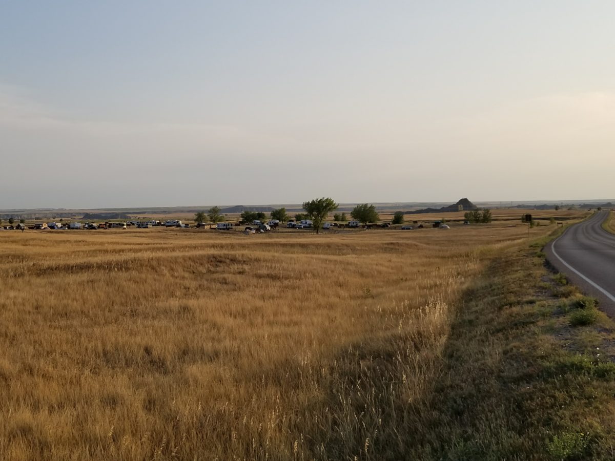
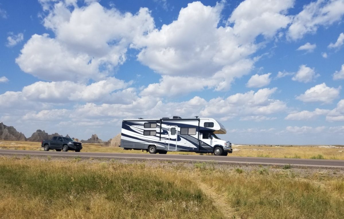
After leaving the visitors center, one of us thought we should head to Mammoth Hot Springs since it was nearby. The other one pointed out the time of day and said we should head for the campground. We agreed after we were moving, necessitating a turn around. We were at one of the places at Yellowstone National Park where the rig could readily turn around. But, leaving the spot, we were suddenly presented with a choice of roads. One of us thought we should go on one road and the other one thought we should go on the other road. We went on the other road. Wow, all my plans to avoid the hardest roads were voided in a split second. Both roads will get you to our destination, Fishing Bridge. We ended up on the narrowest road, one that climbed over Dunraven Pass over Mt. Washburn. Jane was at the wheel. The road was extremely narrow and the switchbacks were acute. There was no way to keep the rig and all the wheels of the truck on the pavement at the same time. My eyes were darting from the view ahead through the windshield, to the view of the truck trailing behind in the rear view camera. In some places the drop off from the pavement was so large, I was afraid that, when the rear wheels of the truck dropped off the pavement, the truck would start over the precipice and pull all of us over the side of the mountain. I literally had to cover my eyes at times!

That poor engine. I feel sorry for it. The elevation of the pass is 8,859 feet. The elevation of the North Entrance is 5,600. That Ford was screaming. The gas E450 Super Duty V-10 has the power, but it was screaming and gasping for oxygen at 9,000 feet. It had a 14,600 pound house on its back and 5,000 pounds of “dead” weight dragging behind. There was no place to pull off; nothing to do but grip the wheel and pray for the best. Finally we reached the top of the pass and there was a turnout with one space large enough for the rig. Thank the good Lord no one else was in it. We pulled off, mashed the parking brake to the floor, turned the engine off, and took deep breaths. (All four of us.) One of the reasons we had been towing this truck all the way from Georgia was to be able to enjoy roads like this in a smaller vehicle.

The parking spot was actually just this side of the crest. It was significantly sloped. As you RV’ers know, you want to connect and disconnect the towed vehicle on as flat a spot as possible. We considered the making the downhill run as is, or whether to attempt to disconnect. I wasn’t sure we could get the tow bar lose with that slope, but we did. Before removing those pins, I made sure Jane was in the truck in case it broke away and started over the cliff.

At the top of the pass, grazing right by the road. He found the flattest spot around.

The downhill run was a piece of cake. Jane piloted the truck and said it felt effortless. The RV also seemed relatively easy, even before the road straightened out. Before reaching Fishing Bridge, we ran through Lamar Valley, where the wildlife congregates late in the afternoon. Now we had to drive around bison and throngs of people in the road. We made it to Fishing Bridge, as is typical, just before dark. This isn’t how we planned it, but reality doesn’t give a whit about plans.

There are no RV’s on this road, a rarity in Yellowstone.
It’s 60 miles on this road — inside the park — from the North Entrance to Fishing Bridge. It’s hard to get our minds around the enormity of this park, 2,219,789 acres.

I’m waiting in the RV, parked behind the truck while Jane registers. A woman walks up and takes a photo of the license plate on the truck. This is the first of several incidences in national parks when people would take pictures of the Georgia plates. That one’s hard to find.

Jane goes first to guide me in. Somehow Jane gets away from me; I don’t see the truck. I’m rounding a sharp curve in the camping loop, not knowing where I’m headed, looking for the truck and trying to watch out for kids on bikes. It’s getting hard to see. Rounding the curve very slowly, I see what looks like a black bean bag land on a board. The loop is so tight, I can only see part of the board. A red bag lands. I start thinking. Then I see the Georgia “G” on the corn hole board. I stop and holler, “I like those colors!”, and get a “Go Dawgs!” response.

We get set up. The beer tastes good. I wonder what the next adventure will be.

Fishing Bridge campsite


August 28 Billings

We could have shortened our driving time by entering Yellowstone at the East entrance. But I, Rob, was intent on entering the Park at the North entrance through the Roosevelt Arch in Gardiner, Montana. Also, I determined that the roads from that direction into the park were better for driving an RV towing a car (truck, in our case). We drove through a corner of Wyoming and into Montana to Billings. We camped at the Billings KOA on banks of the Yellowstone River. One thing different about this campground is that they cooked and served steak and ribs outside. At dinner, we met Mike and Mary, also headed to Yellowstone, from Jacksonville, Illinois. I had never heard of Jacksonville, Illinois before this trip. The men we met in Mexico, Missouri during the eclipse were also from that town. Mike and Mary had been to Glacier 17 times. Mike told us the places to eat, drink, and hike in Glacier. This is their first time visiting the park in a camper.

Billings KOA

It’s 96° in Lodge Grass, Montana 4 p.m., on the way to 98. There has been no rain out here for three months.

When we first experienced the big sky views of South Dakota, we were surprised by how hazy it was there. It looked like the Smoky Mountains in July, but I knew the humidity was very low. I found that the reported air quality was unhealthy – particulate matter. That was our first encounter with the forest fire smoke that would plague us for more than a week.


August 27 Missiles and Spearfish

There is one campground in Badlands Natl Park, Cedar Pass, not including one or two hike-in back country ones. This is not a criticism, just an observation that may help prepare any of you who may take an RV here.  It is a paved loop plus a road bisecting the loop. Tent sites are along the outer parts and sites to accommodate RV’s on the inner part. Some of the sites do not have enough room for a larger RV, much less with a towed vehicle. Certainly we have done tent camping, but this trip is not that kind of experience. We only made reservations back in April, so I guess we got the last site available. First, we had to (or did, anyway) come in the wrong way (opposite to the posted direction), so that our door was facing the open area rather than out into the street. (We weren’t the only ones to do it.) Next, we backed the truck up as close as possible to RV. I made sure the Rock Hard 4×4 off road bumper was the part facing the traffic! I also put out traffic cones, which I wisely provisioned among everything else imaginable, but not quite, for the trip. (The first 52 degree night, I wish I had thought of pajamas.) The site was so sloped we never got it level. It was next to the “bathrooms” (oh, there was no “bath” in the bathroom, just toilets) and across from the dumpster. The florescent light from the bathrooms blotted out the Milky Way. Again, I am not complaining. Just catching up on the “telling it like it is” category. We had reservations for four nights, but we could not reserve one site for the whole time. The first night was in one site, then the next day we had to move to the site right next to us. There is no water hook up at these sites; only electricity. You fill your fresh water tank at a one of a few spigots around the campground.  Only after we got the vehicles positioned did we realize we needed to get to a water spigot. We connected our extra length of hose and with the double length, were able to reach the spigot to take on some water without moving. The next morning, since we knew we could reach the water from our current position, one of us thought we should go ahead and fill the fresh tank before moving to the site next door. The other one of us said, no, let’s move first, we can still reach the water with the double length of hose. So we set up at the next site. Then we tried to get water and were 10 feet short. One of us wanted to move the rig back a short distance before we were completely set up in order to get water. One of us was insistent that we not move it and that the one could complete filling the tank by using buckets or pitchers. One of us said, “No way.” One of us said, “Watch me.” Now we both know that you can’t fill the fresh tank inlet with a bucket or pitcher. We never got any more water.

Tent site with nice view

Not complaining, but considering everything; having to be stingy with the water, the leaning floor, the unwanted illumination, having obtained enough practice of my fly-catching skills on the rascals coming from the dumpster, et cetera, et cetera; in the afternoon of the day before we had to leave, we pulled up stakes and headed for an oasis to the west. Good old KOA. Water! Sewer and electricity! And flat, or flatter, sites. A night at the Spearfish, South Dakota KOA, and a shorter drive to our next destination.

[Note: The park’s Cedar Pass campground is on the park boundary. You can see the sign for the private KOA campground just outside the park boundary.]

After leaving Badlands, we stopped at the Minuteman Missile National Historic Site near I-90.

A photo displayed at the Minuteman Missile Historic Site

We even drove out into a field a few miles from the museum on a dirt road to a launch silo.

It’s a dummy.
Sign on the chain: “Please keep the chain fastened to keep cows out.”

The Spearfish KOA has large grassed areas, big trees, and a cornfield in back.  We left a largely asphalt campsite in a national park for the peaceful greenery of a national corporate campground. Ironic?

As we pulled in, a man was sitting outside the camper next door reading a book and waiting on the charcoal in his grill to turn gray. He let me get hooked up, then said, “Hi, new neighbors.” His wife drove up with the groceries. They had a Florida tag. We had not seen any other tags from the Southeast. They were from Jacksonville. His wife worked on the road, a “project manager.” He said that she just talks on the phone all day. I don’t think he had any work. He had recently completed an Alaska journey in the RV. His wife did not go on that trip; he went with his brother. His brother departed somewhere along the way and his wife had recently joined him at a nearby airport. His towed vehicle was a Jeep Wrangler. The front of the Wrangler was covered with dents from hundreds of miles of gravel roads in Alaska and one headlight was busted. He said if I went to Alaska, not to get a “hula” skirt. I don’t know what other kinds of skirts they have for RV’s. The Jeep took them all the way, though, when the RV conked out. He and his brother loaded into the Jeep and continued the journey while the RV was getting $12,000 worth of repairs, including a new engine.


August 24 The Badlands

I’m excited — we’re really out West now! I expected to see John Wayne ride over the hill any minute.

We realized that we had many pictures of the Forester at the campsites, but none out on the road. Obviously, that’s because we’re usually in the front seat while it’s rolling. So, we pulled over in Badlands National Park and I, Rob, walked out into the grassland to get the a photo of the rig on the road. Jane took the above photo of me going out to get the photo of the rig. While I was hurrying out to get the the photo, my leg suddenly disappeared down a hole two feet deep. I assume it was a prairie dog hole. I was OK, and, fortunately, got my leg back without a rattler attached. Another incident in the disaster avoided category. And another time that made me think later, “I shouldn’t have done that.”

Our camera was busy. We are including a few of the many photos. I kept trying to capture an experience that is not possible to capture. I love the openness out here. And the landscape is so different than what we Easterners experience. Some of the scenes look like it could be on the moon. The old saying, “a picture is worth a thousand words,” is so true, isn’t it?

Turkey


Bigfoot Pass


Jane is overlooking Bigfoot Pass, the trail where Big Foot made his way to Broken Knee Creek in 1890 five days before his death. The road curves over the ridge from here and drops down to a flat pass through the hills about 2,000 yard from this spot. Only one other person came out to this point while we ate sandwiches there. An interpretive sign stated that the trail below was the trail used by Big Foot and his group. The lady looked down at a wildlife trail or wash about 200 feet below the cliff and said, “So, was that the trail that Big Foot used?” I said, “No, it would be that one there in the distance with asphalt on it.” She gave me a look that said something like, “That’s so stupid; the trail Big Foot walked on was not paved.”

In the “tell it like it is” category:
We wanted to eat at the lodge in the park. Our vision of the lodge was something like the Old Faithful Inn in Yellowstone. Instead, the Badlands Cedar Pass “Lodge” is a one-story concrete block building that includes some exhibits, a theater, bookstore and a cafe. At the cafe, we ordered a steak to split between the two of us. I (Rob) wasn’t going to complain about the poor food quality, but when checking out, the person at the register asked, “How was your food?.” I just answered honestly. I said, “Well, from the smell of the baked potato, I could tell it was cooked a long time ago and I didn’t touch it. The steak was digestible.” He immediately whirled around and howled with laughter. He said, “Oh, you’ve just made my day!” He was so surprised when someone answered frankly. He was a college student working in the park for the summer; it didn’t affect him one way or the other how the food was. He was tickled to have the everyday boredom broken up by the unexpected.

Of course we didn’t go to the Badlands for a restaurant. We loved the Badlands National Park. I loved it when the park ranger said, “Here at the Badlands, unlike other national parks, you can go anywhere you want. You don’t have to stay on any marked trails.”  He did give the safety lecture about water, good shoes, and watching out for rattlesnakes. The Badlands lose one inch a year of soil to wind and water erosion, so there is no way we can do anything like that much damage by walking or climbing on anything, so have at it. At your own risk. I like the ring of freedom in that.


August 23 Corn, USA

We departed Rock Port to continue up the Missouri (more specifically, Interstate 90) all the way through Iowa and into South Dakota. we couldn’t resist crossing the river for a brief visit to Nebraska, though. I, Rob, had been in Nebraska once before, briefly, for a presentation at Offutt Air Force Base. That was one of the most interesting trips of my life, but that’s a story for another day. We covered a corner of Nebraska before crossing the river again into Iowa at Nebraska City. There, we drove by the Lewis and Clark Interpretive Center. In this rig, we don’t make many unplanned stops along the road, but we stopped here and learned a lot in a short visit.

A replica of the Lewis and Clark keel boat. It was made for the IMAX movie.

We camped tonight in Mitchell, South Dakota. We saw signs for the Corn Palace all over. I asked the lady at the campground what a Corn Palace was. She stammered and finally said, “Well, they’re have a corn eating contest tonight.” Of course, we took off for the Corn Palace, and I learned a lot. I asked a lady on the street in front of the Palace what a Corn Palace was, and she failed to answer also. Then she spotted the General Manager of the Palace coming down the street and introduced us to him. I said, “Scott, at this moment, I don’t know what a Corn Palace is.” He told me that the Palace was decorated with different murals created each year with different colors of corn, sorghum, and other grains. Fantastic. Inside, we studied the historical exhibits and learned the context in which the Corn Palace came to be.

Later, I realized that the lady at the campground couldn’t conceive of someone really not knowing what a corn palace was. It has always been part of her life and she couldn’t describe the thing in a sentence or two.

We have a knack for serendipitously arriving in towns when festivals are occurring. We visited a town in Japan once for one night and it happened to be the day of the annual fertility festival. That was the most interesting festival I think we will ever attend, but that is a story for another day.

Everything you see in the photo of the Palace that you think might be corn, is corn.

With Scott, the Corn Palace General Manager
The Corn Palace, Mitchell, South Dakota
It’s 56 pounds


August 22 Corn and Soybeans

We drove across Missouri today through a billion acres of corn along the Missouri River as far as you can go and still be in Missouri. We camped near the river in Rock Port. This is the path taken by Lewis and Clark. If it is a good campsite now, it must have been back in 1804. So I like to think that I am sleeping where Lewis, Clark and their men camped long ago.

We’ve left trees behind for a while; we had soybeans for neighbors in Rock Port.


August 21 The Sun Came Shining, then left, then came back

Since the park was out of the path of totality, we studied Google Maps to select the place where we wanted to view the eclipse. Being in a sparsely populated area, we did not have to get into any traffic or crowds. We drove south about an hour to a country church yard near Mexico, Mo. (Not many can say they viewed the eclipse from Mexico!)

Jane packed a picnic lunch and I added a few beers. We set up our lawn chairs and enjoyed the picnic and the show. We were the only ones in sight at first. Then three men arrived from Jacksonville, Illinois. Bill, an 86 year old man from Jacksonville came with his son and his son’s friend who was visiting from the Philippines. Two men and a woman came out of a house across the road and set up their chairs in their front yard. A motorcyclist arrived just after the eclipse started.

There were some clouds but we were on the edge of the cloud cover and had a good view most of the time. When the light began to fade the cicadas made their evening sounds. We had about two minutes of darkness. The lights around the church came on. When the sun reemerged, we heard a rooster crow. I gave Bill a beer. Everyone left before the end but Jane and I watched all of it.  It was a wonderful day.

Pleasant Grove, near Mexico
Sunny
Getting dark
Dark


August 19 Florida and Hannibal

While admiring this entrance to Florida, the town of Mark Twain’s birth, a pickup truck stopped across the road. A man wearing jeans and a seed company hat asked if we wanted him to take our picture. I said that was mighty nice of him to stop and come all the way across the road to do that. He said, “Awh, I don’t have anything else to do. I just put my sister-in-law’s boat in the water for her, and I was on my way to the winery to have a beer.” (There are two things in Florida – a very small winery and a marker showing where the house of Mark Twain’s birth was moved from.) I had three thoughts: It’s odd to go to a winery to have a beer; people sure are nice around here; and I’d like to go and have a beer with this man.

Tidbit: The two-room cabin where Samuel Clements was born now stands about one-half mile down the road. In 1959, the state built a building around it and created a museum.

Tom tricked me into this.